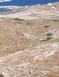
An aerial perspective produces immediate visual information that is not discernable from the ground. Even the most well trained eye of a specialist surveyor can miss outstanding features if the archaeology site is only surveyed at ground level.
Archaeology prospecting can be greatly enhanced by aerial photography before excavation. A strong visual contrast of ground-based features is presented by aerial photography of an excavation site.
Methods of Aerial Photography
Aerial photographs are obtained by using various means of elevating the camera. Some of the techniques to deploy a camera are:
- Manned fixed wing aircraft
- Manned helicopter
- Manned Parasailers
- Manned and unmanned balloons
- Radio controlled unmanned aircraft and helicopters
- Ground controlled kites.
Requesting Aerial Photographs For An Archaeology Site
Aerial photography is site driven and is targeted to a specific locality. Most often an archaeology ground survey party has arrived at the decision to employ aerial photography platforms after completing at least a walk over survey of a potential archaeology excavation site. Certain evidence observed by the archaeology survey will trigger the site director to request aerial photographs.
A variety of media is used including standard black and white and colour negative film, infra-red and ultra-violet sensitive film, and now more commonly, digital imaging devices. Archaeologicy teams use photographs from permanent satellite mounted cameras but this technology is outside of their control and archaeologists simply buy into the products on offer rather than be the initiators of the methodology themselves.
The History of Aerial Photography
Almost as soon as the camera was invented people were ascending the skies in balloons to capture the unique perspective that only the birds see. As land based features, that were otherwise unnoticed from the ground, were identified while in the air, it was only natural that entrepreneurs sought to share this exclusive view with others – for a fee.
The mysterious stone circle at Stonehenge, although not particularly remarkable in its neglected state in 1906, was one of the first archaeology sites to be photographed from the air. Although aerial photography was used during the Great War, it was not until after aerial developments during World War 2 that its use in archaeology became more popular.
During WW2 it became apparent that the accurate interpretation of aerial photographs required trained personnel. British and French specialists furthered the work in the Middle East – Britain in Mandated Palestine and France across Lebanon.
The Routine Method of Archaeology Surveying
Reconnoitering an archaeology site with aerial photography has become a routine practice for most recognised excavation expeditions across Europe and the Middle East. With digital imaging technologies being a cost-effective method of data collection, excavation site directors would be imprudent not to include aerial photographs as part of the initial survey work. Also, aerial photography can provide a timed progress perspective from season to season showing the progress or otherwise of the excavation from an aerial vantage point. This can be especially helpful to assist financial donors to understand the extent of the overall archaeology excavation site.
What Perspective In Photography Means
Major mapping companies and government agencies often use aerial photography for various purposes. These photographs generally need to be taken with a directly vertical perspective to be of suitable use. However, to be useful in archaeology examination many excavation sites need to be photographed from an oblique perspective and great consideration needs to be contemplated with regard to lighting.
One dichotomy for the archaeology aerial photographer is that photographs taken with the sun directly above will be very difficult to translate due to the lack of ‘object contrast’. However, the more the sun is acute across the scene the greater is the ‘image contrast’ and forces highlights and shadows to be outside of the range of the photographic media.
The cameras and software used to capture, process, and archive aerial photographs from archaeology sites has enhanced the survey techniques of the excavation team. These specialist fields are now opening their doors to the non-specialist who can be employed in the field along with regular field staff.